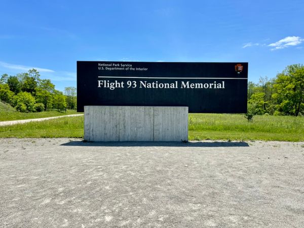
Trip Report - Natchez Trace Parkway
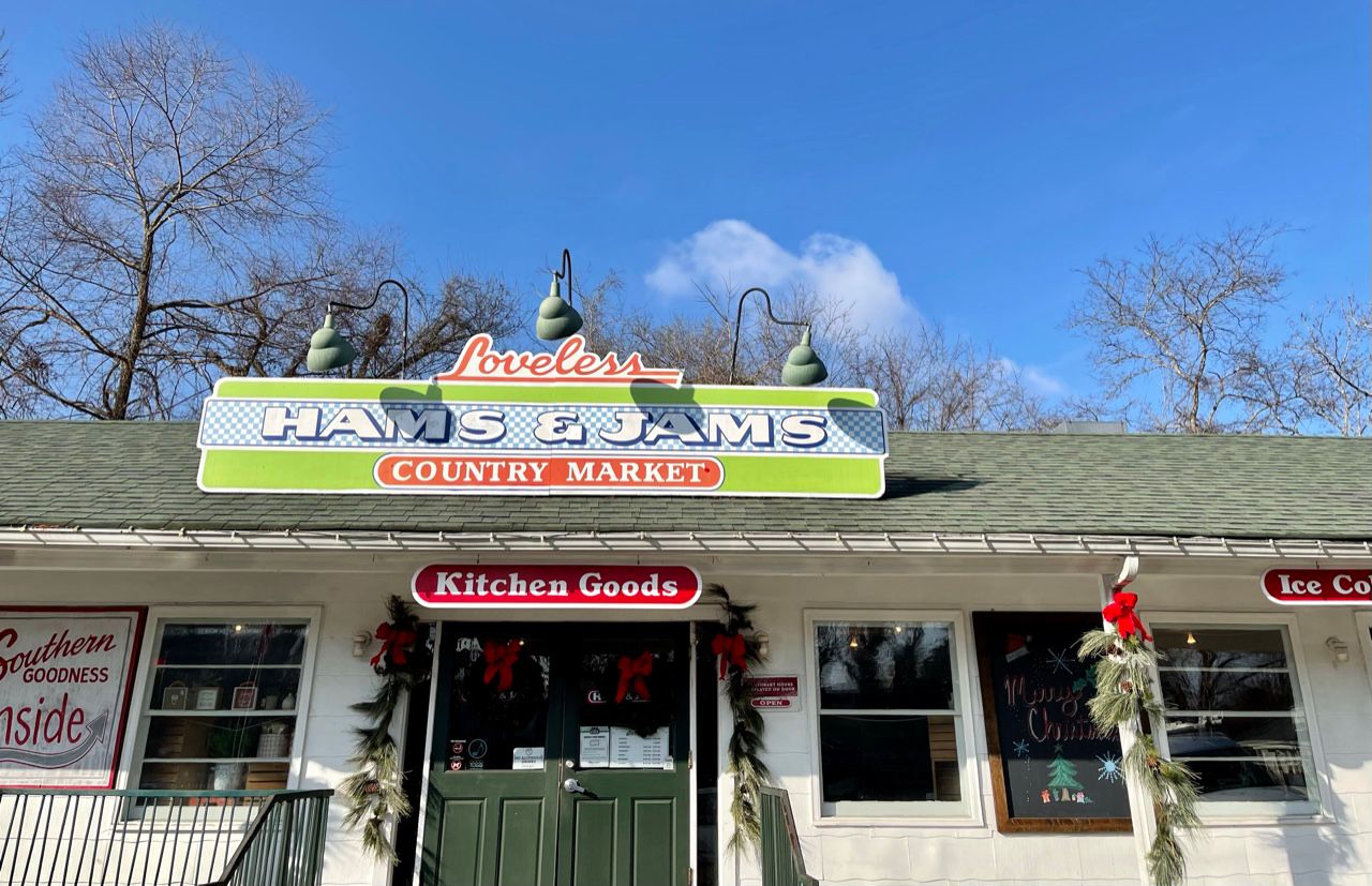
We started the day at the northern terminus for the Natchez Trace Parkway. This isn’t easy to find on Google maps, for example, so we used the Loveless Cafe to navigate. It’s right near the terminus and famous for biscuits and jam.
From there, we were able to locate the start of the Natchez Trace Parkway.
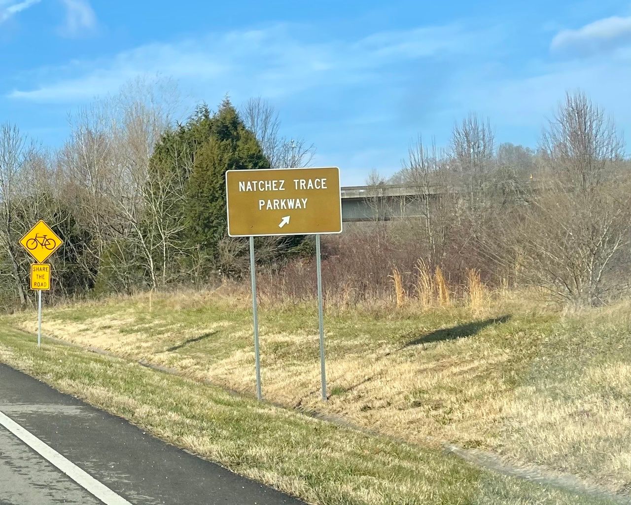
The Parkway is marked with mile markers, which correspond to the markers on the brochure map from the National Parks Service, which is available on their website. They don’t seem to start right away, though, because we looked in vain for the first stop for a few miles.
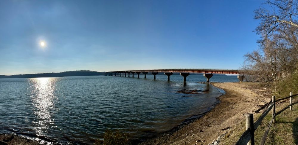
The first place to really stop if you are heading south from Nashville is the Double Arch Bridge. It looks like it’s right at the beginning of the drive, and other things we read suggested the stop was almost immediate, but it wasn’t, being nearly 9 miles in. There was a small bridge at the start, and I thought maybe that was it, but we had passed it. We hadn’t missed it, however, and eventually found the right spot, which is Birdsong Hollow.
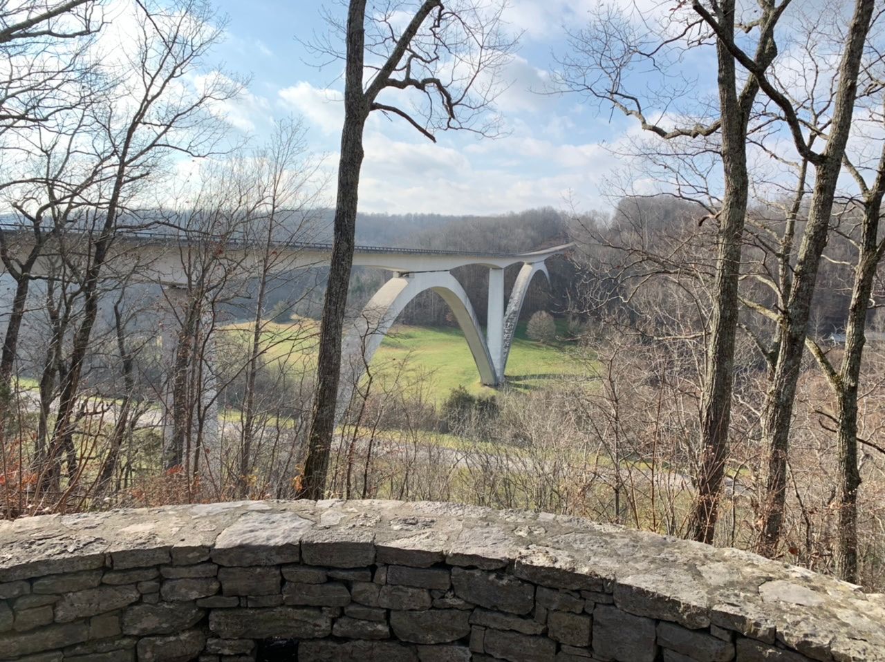
We pull off at Birdsong Hollow, where there's a blank signboard and a large parking lot. No one else was there. We then took the short path, maybe 500 feet or so to the viewing area and saw the bridge.After you leave Birdsong Hollow, you cross over the bridge in your car.
Our next stop was Timberland Park, where we enjoyed some hikes.

We then stopped at the Garrison Creek pull-out and there’s a two-mile hike between there and the War of 1812 Memorial, but we didn’t do it.
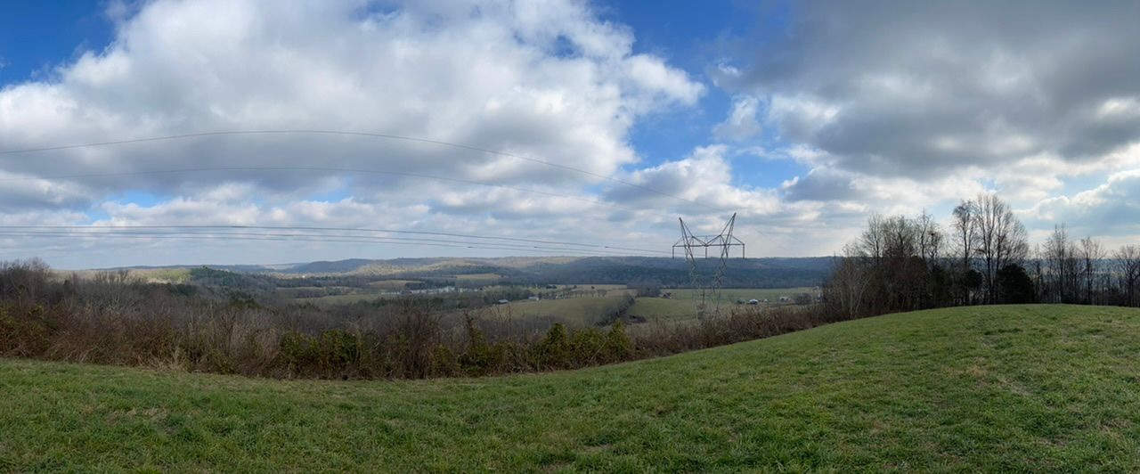
There are hiking trails connecting nearly all of the Trace, and many people ride bikes and motorcycles along the Parkway. Our next stop was the Water Valley Overlook, which would be a fantastic place to have a picnic. There are picnic tables and amazing views of the whole valley. There were a few other folks out walking around the area when we were there.
After Water Valley, we stopped at the Gordon House Historic Site, which had bathrooms and picnic tables.
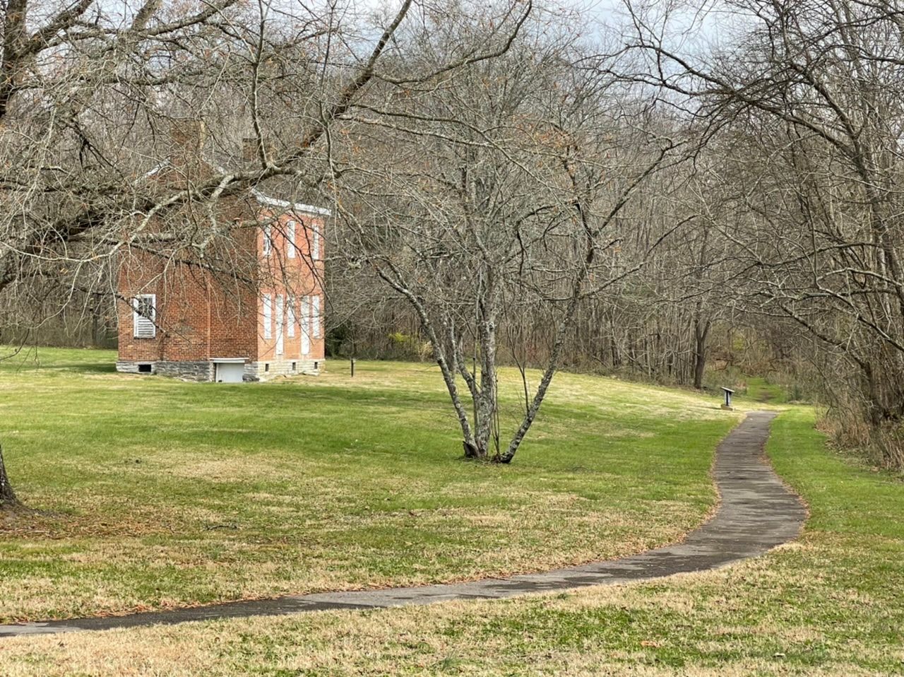
The Gordon House is associated with the Old Natchez Trace. John Gordon was a ferry operator who the sign at the site tells us “made an agreement with the Chickasaw Chief George Colbery to operate a trading post and ferry on the Duck River.” As it turned out, he barely lived there, being kept busy with the military by General Andrew Jackson, but his wife Dorothea Gordan supervised the construction, which was completed in 1818, and lived there until her death in 1859.
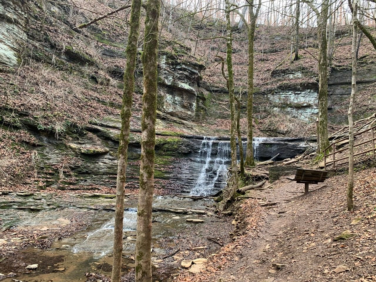
The next place we stopped was the Baker Bluff Overlook at mile 405.1, from where we hiked to Jackson Falls, which is a gorgeous waterfall and our number one recommendation for stops along the Natchez Trace Parkway.
On the way back to the car at Baker Bluff Overlook, we considered leaving one parent and the kids at the pavilion and having someone fetch the car, but decided in the end to all stay together. I’m not sure that was the wisest decision as it cost us some of our limited daylight time and made the kids tired.
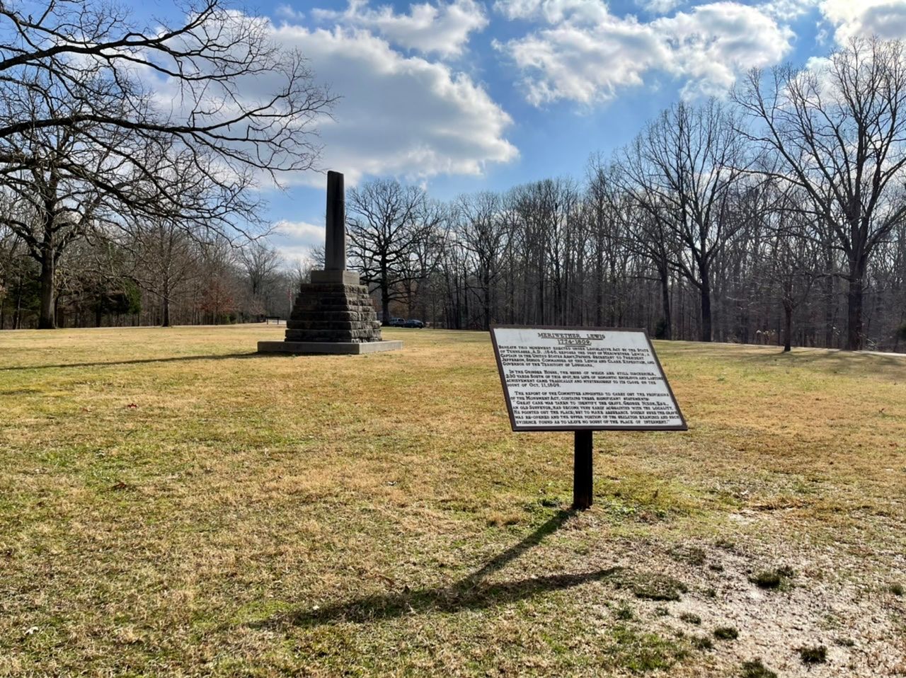
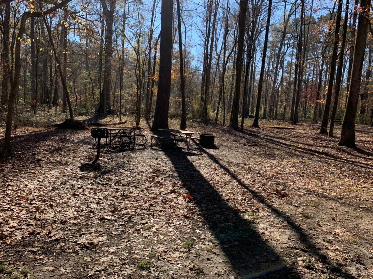
The Meriwether Lewis stop includes the first of three free campgrounds along the Natchez Trace Parkway, so we pulled over to take a look. This area also has bathrooms, picnic tables, a ranger station, and the Meriwether Lewis Memorial.
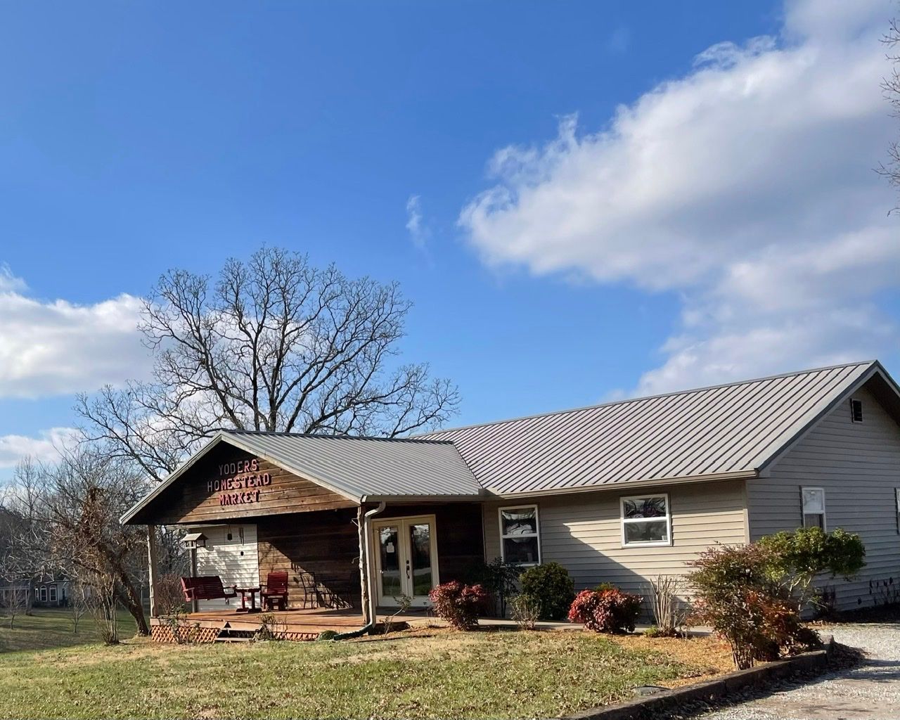
We were all ready for lunch after this, so we left the Natchez Trace Parkway and stopped at Yoder's Homestead Market, a family-owned Amish bakery and deli. We got some fantastic sandwiches (I highly recommend the reuben) and cinnamon rolls for breakfast the next day.
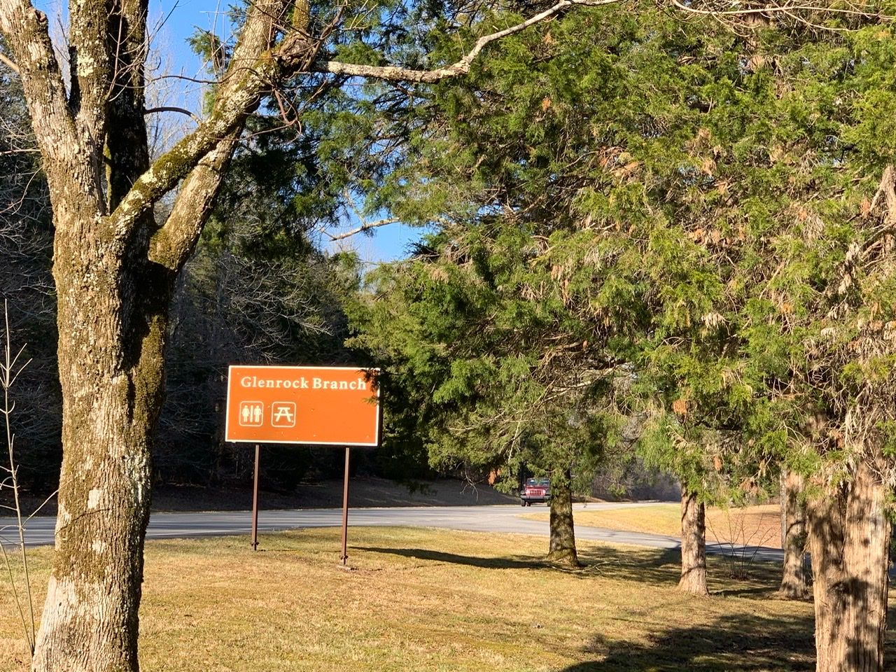
After lunch, we realized that we had a long way to go to get to the hotel in Jackson, MS tonight and that it was getting late. So we skipped a lot of pullouts, with our next stop at the Glenrock Branch picnic area to use the bathrooms and check out the pretty view.
We'd eaten in the car, so didn't use the picnic tables, though that would have been a nice place to have lunch.
Then we crossed over into Alabama. This was a bigger deal than a normal state line crossing, and they had a big sign there from the National Parks Service marking the boundary.
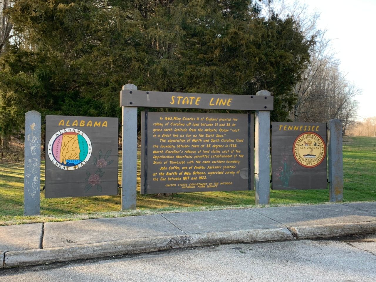
It says that the southern boundary of Tennessee is in line with the southern boundary of North Carolina. This line was set in 1663 by King Charles II, who had originally granted the state land west to the sea. But North Carolina released claims on land west of the Appalachians in 1735. Shortly after the border, we crossed the Tennessee River and it was so beautiful we pulled over to take a photo.

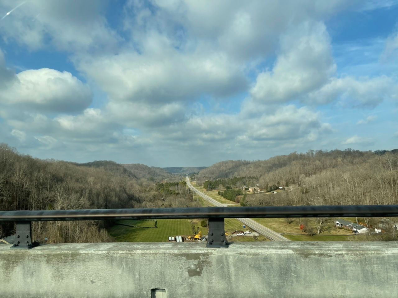
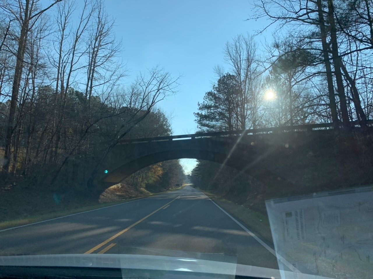
The sun was already getting lower, and we took some photos of the bridge at the Water Route Overlook as we were driving.
Our next stop was Bear Creek Mound. Ancient peoples built this mound and there used to be a temple on top of it.
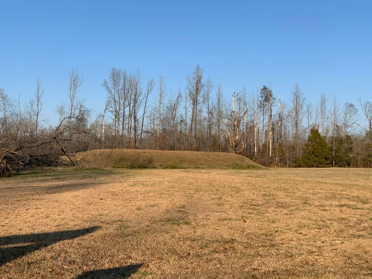
The sign there says it was used by migratory people from about 8000 BCE to 1000 CE.
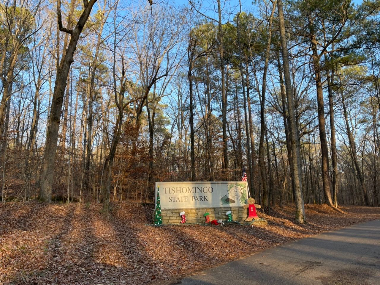
We stopped at Tishomingo State Park just across the Mississippi border, but didn't have time to hike any trails, so it didn't make sense to pay the day use fee just to turn around. I definitely want to come back here and camp sometime, though. It's supposed to be one of the most beautiful parks in Mississippi and the photos I've seen online demand a return.
Then it started getting really dark and there were a lot of deer. I was driving and saw at least two dozen. Vagish, in the passenger seat, saw at least double that. I was actually shocked that we didn’t see a single dead one. Are these deer just smarter than the ones I’m used to in other states? Or are folks out here just really on top of cleaning them up off the road?
We realized how much time we could save if we drove straight to Jackson on a bigger highway, so pulled off the Trace and drove directly to our hotel, the Quality Inn in Jackson, MS. We had selected it partly because it had an indoor pool and were disappointed to find the pool padlocked, presumably because of Covid. Thankfully we hadn't gotten the kids excited about a pool, waiting to see if there was one.
I had done a little bit of research on Jackson, hoping there would be time to do something, but realized how far we'd have to drive the next day to get to Davis Bayou, so had to give up on that. BUT...when we come back to Jackson, Mississippi, we are going to LeFleur's Bluff State Park and the Mississippi Petrified Forest.
We left Jackson, MS to finish the Natchez Trace Parkway. This turned out to be a bit of a mistake. When we got onto the Parkway from Jackson, it was really poorly maintained with a lot of damage to the road. I wondered if the states are responsible for maintaining it and MS just didn’t do as well as AL or TN. However, this quickly got better, so I don't know what the issue was. Plus, taking the Parkway meant a much longer route to get to Davis Bayou, our next campsite along the Gulf Coast National Seashore, going further west than necessary, and part of the reason I wanted to do it was to go to the Natchez Trace Parkway Visitor Center and get stamps for the kids’ national parks passports and see if they participated in the Junior Ranger program. The visitor center was closed, so we weren’t able to do that. At least they had the official map out, so I picked that up. It’s available online, though, and we’d been using it all along.
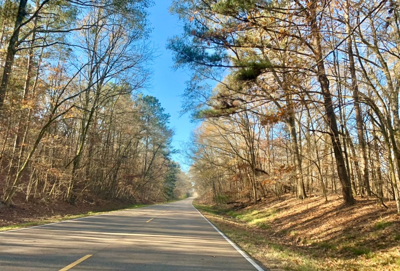
At any rate, the Parkway is a beautiful drive, even in the winter. It must be truly spectacular in the fall, when there are lots of different colors of leaves on the trees. Even when the leaves are green, this would be gorgeous. We saw more foliage as we headed south, but there were a lot of bare branches.
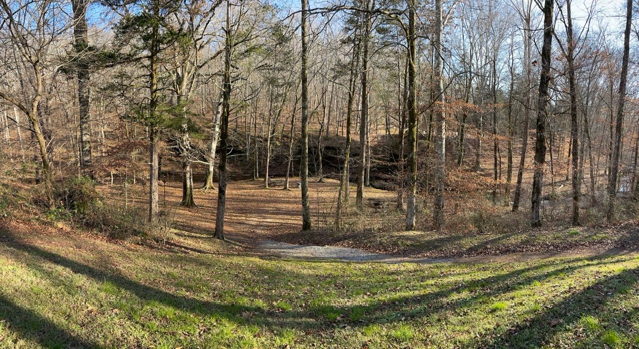
We did stop that morning to check out the Rocky Springs Campground, which is one of the three free, primitive, non-reservable campgrounds run by the National Park Service along the Natchez Trace National Parkway.
Almost immediately after Rocky Springs is the Owens Creek Waterfall, which shows hiking on the map, but we missed it and opted not to turn around. Now it's one more place we'll have to stop on our next trip.
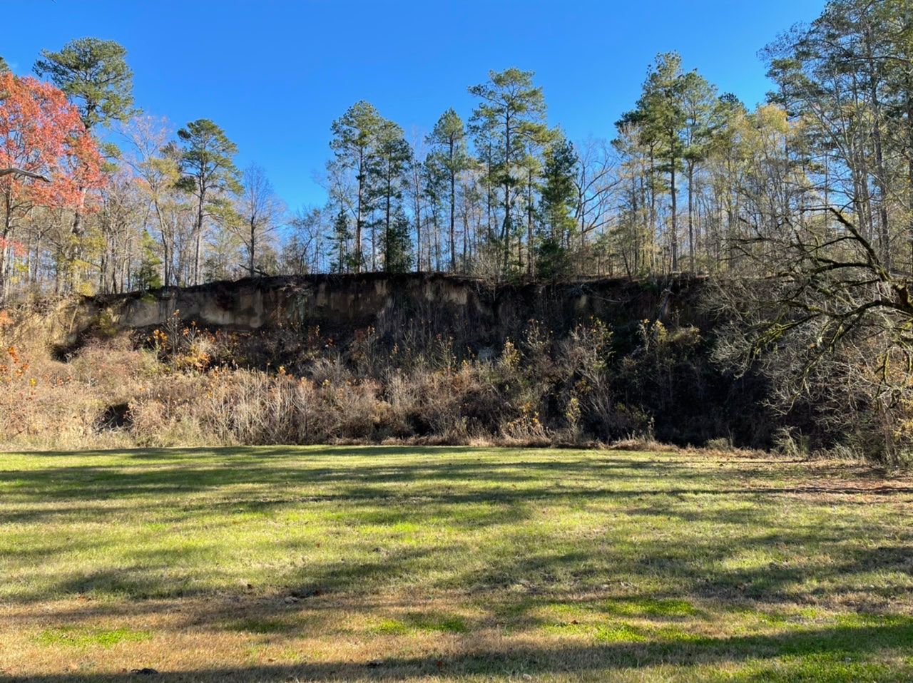
Our next stop was Loess Bluff. Loess was a new word for me. It is "a deposit of windblown topsoil." Wind storms would blow soil from the west and deposit it here, in some places as deep as 90 feet. The sign here says that where the Old Natchez Trace passed over loess, it would sometimes be sunk down as much as 20 feet.
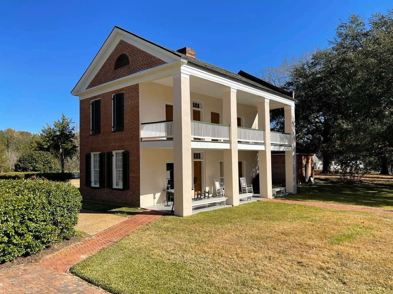
We then stopped at the nearby Melrose Natchez National Historic Park, which is an old cotton estate that had a number of enslaved people. We looked around the buildings for a while, and the kids earned their Junior Ranger badges, but when we realized the bathrooms were closed had to move on fairly quickly.
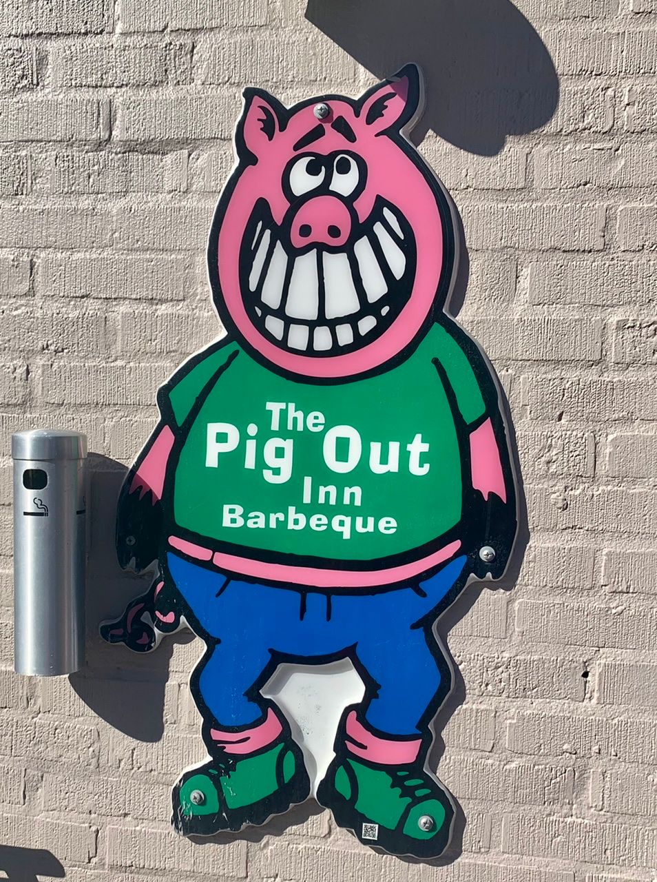
That was our last stop before the Natchez Historical Park Visitor Center, and we really enjoyed our trip down here and definitely plan to come back and see all the things we had to miss on this quick trip! The Visitor Center was closed, though the bathrooms were open, thankfully. The weather was beautiful, and they had room for the kids to run around and tables set up outside, so we got some take out from the nearby Pig Out Inn Barbeque and ate there.
We made the mistake of getting a grape Fanta out of the vending machine to have with lunch and I think the kids may now be addicted to soda.